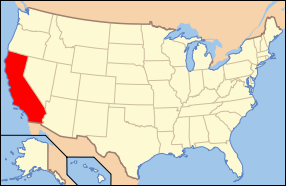
Placer County, California
| County of Placer | |||
|---|---|---|---|
| — County — | |||
|
|||
 |
|||
 |
|||
| Country | United States | ||
| State | California | ||
| Regions | Sacramento Valley/Sierra Nevada | ||
| Metro area | Sacramento metropolitan area | ||
| Incorporated | 1851 | ||
| County seat | Auburn | ||
| Largest city | Roseville | ||
| Area | |||
| - Total | 1,503 sq mi (3,892.8 km2) | ||
| - Land | 1,404 sq mi (3,636.3 km2) | ||
| - Water | 98 sq mi (253.8 km2) | ||
| Population (2008 Est.) | 341,945 | ||
| - Density | 231/sq mi (89.2/km2) | ||
| Time zone | Pacific Standard Time (UTC-8) | ||
| - Summer (DST) | Pacific Daylight Time (UTC-7) | ||
| Website | www.placer.ca.gov | ||

Placer County is a county located in both the Sacramento Valley and Sierra Nevada regions of the U.S. state of California, in what is known as the Gold Country. It stretches from the suburbs of Sacramento to Lake Tahoe and the Nevada border. Because of the expansion of the Sacramento metropolitan area, Placer County is one of the fastest growing counties in the state. Between 2000 and 2008, the population grew from 248,399 to 338,750.[1] The county seat is Auburn.
Contents |
History
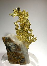
Placer County was home to the peaceful (Nisenan) Maidu and Miwok Native Americans for hundreds of years before the discovery of gold in 1848 brought hordes of miners from around the world. Only three years after the discovery of gold, the fast-growing county was formed from portions of Sutter and Yuba counties on April 25, 1851 with Auburn as the county seat. Placer County took its name from the Spanish word for sand or gravel deposits containing gold. Miners washed away the gravel, leaving the heavier gold, in a process known as "placer mining."
Gold mining was a major industry through the 1880s, but gradually the new residents turned to farming the fertile foothill soil, harvesting timber and working for the Southern Pacific Railroad. Auburn was settled when Claude Chana discovered gold in Auburn Ravine in May 1848 and later became a shipping and supply center for the surrounding gold camps. The cornerstone of Placer's beautiful and historic courthouse, which is clearly visible from Interstate 80 through Auburn, was laid on July 4, 1894. The building itself was renovated during the late 1980s and continues to serve the public today with courtrooms, a historic sheriff's office and the Placer County Museum. Roseville, once a small agricultural center, became a major railroad center and grew to the county's most populous city after Southern Pacific Railroad moved its railroad switching yards there in 1908.
Loomis and Newcastle began as mining towns, but soon became centers of a booming fruit-growing industry, supporting many local packing houses. Penryn was founded by a Welsh miner, Griffith Griffith, who turned from mining to establish a large granite quarry. Rocklin began as a railroad town and became home to a number of granite quarries. Rapidly growing Rocklin now vies with Roseville for the honor of being Placer's largest city. Lincoln and Sheridan continue to support ranching and farming. Lincoln also is the home of one of the county's oldest businesses, the Gladding McBean terra cotta clay manufacturing plant established in 1875.
Geography
According to the U.S. Census Bureau, the county has a total area of 1,503 square miles (3,893 km2), of which 1,404 square miles (3,636 km2) are land and 98 square miles (254 km2) (6.55%) are water. Watercourses in Placer County include the American River and Bunch Creek. Lake Tahoe has 40.96% of its surface area in Placer County, more than in any of the four other counties in which it lies.[2]
Incorporated cities
- Auburn
- Colfax
- Lincoln
- Rocklin
- Roseville
Incorporated towns
- Loomis
Unincorporated places
- Alta
- Baxter
- Carnelian Bay
- Dollar Point
- Dutch Flat
- Foresthill
- Granite Bay
- Kings Beach
- Kingvale
- Meadow Vista
- Newcastle
- North Auburn
- Ophir
- Penryn
- Olympic Valley
- Sheridan
- Sunnyside-Tahoe City
- Tahoe Vista
- Weimar
Adjacent counties
- El Dorado County, California - south
- Sacramento County, California - southwest
- Sutter County, California - west
- Yuba County, California - northwest
- Nevada County, California - north
- Washoe County, Nevada - east
- Carson City, Nevada - east
- Douglas County, Nevada - southeast
See also: List of counties bordering eight or more counties
National protected areas
- El Dorado National Forest in part
- Tahoe National Forest in part
Transportation infrastructure
Major highways
.svg.png) Interstate 80
Interstate 80 State Route 28
 State Route 49
 State Route 65
 State Route 89
 State Route 174
 State Route 267
Public transportation
- Placer County Transit provides basic bus service primarily along the I-80 corridor between Alta and the Watt Ave. Sacramento Regional Transit light rail station. PCT also runs commuter service to Downtown Sacramento.
- The cities of Auburn, Lincoln, and Roseville have their own local transit service. The city of Roseville also offers a commuter service to Sacramento.
- Gold Country Stage (Nevada County) provides a connection between Auburn and Grass Valley.
- Tahoe Area Regional Transit operates in Truckee (Nevada County), Tahoe City and along the North Shore of Lake Tahoe to Incline Village, Nevada.
- Greyhound and Amtrak provide long distance intercity service.
Airports
There are three general aviation airports in Placer County:
- Lincoln Regional Airport
- Auburn Airport
- Truckee-Tahoe Airport
The closest commercial airport is Sacramento International Airport in Sacramento.
Demographics
As of the census[3] of 2000, there were 248,399 people, 93,382 households, and 67,701 families residing in the county. The population density was 177 people per square mile (68/km²). There were 107,302 housing units at an average density of 76 per square mile (30/km²). The racial makeup of the county was 88.59% White, 0.82% Black or African American, 0.89% Native American, 2.95% Asian, 0.16% Pacific Islander, 3.39% from other races, and 3.21% from two or more races. 9.67% of the population were Hispanic or Latino of any race. 15.5% were of German, 12.3% English, 10.6% Irish, 7.1% Italian and 7.0% American ancestry according to Census 2000. 89.7% spoke English and 6.0% Spanish as their first language.
| Year | GOP | DEM | Others |
|---|---|---|---|
| 2008 | 54.5% 80,209 | 43.8% 64,460 | 1.7% 2,465 |
| 2004 | 62.6% 95,969 | 36.3% 55,573 | 1.1% 1,736 |
| 2000 | 59.3% 69,835 | 36.0% 42,449 | 4.7% 5,515 |
| 1996 | 52.8% 49,808 | 37.1% 34,981 | 10.2% 9,638 |
| 1992 | 41.9% 38,298 | 33.7% 30,783 | 24.4% 22,285 |
| 1988 | 59.6% 42,096 | 39.0% 27,516 | 1.5% 1,030 |
| 1984 | 62.9% 38,035 | 35.2% 21,294 | 1.8% 1,098 |
| 1980 | 54.8% 28,179 | 33.7% 17,311 | 11.6% 5,950 |
| 1976 | 45.0% 18,154 | 52.2% 21,026 | 2.8% 1,131 |
| 1972 | 50.3% 18,597 | 45.8% 16,911 | 3.9% 1,437 |
| 1968 | 42.6% 12,427 | 48.2% 14,050 | 9.2% 2,667 |
| 1964 | 33.9% 9,389 | 66.0% 18,256 | 0.1% 31 |
| 1960 | 43.8% 10,439 | 55.8% 13,304 | 0.5% 120 |
There were 93,382 households out of which 35.30% had children under the age of 18 living with them, 59.40% were married couples living together, 9.20% had a female householder with no husband present, and 27.50% were non-families. 21.30% of all households were made up of individuals and 8.10% had someone living alone who was 65 years of age or older. The average household size was 2.63 and the average family size was 3.06.
In the county the population was spread out with 26.50% under the age of 18, 6.90% from 18 to 24, 29.00% from 25 to 44, 24.50% from 45 to 64, and 13.10% who were 65 years of age or older. The median age was 38 years. For every 100 females there were 96.40 males. For every 100 females age 18 and over, there were 93.90 males.
The median income for a household in the county was $57,535, and the median income for a family was $65,858 (these figures had risen to $68,463 and $80,987 respectively as of a 2007 estimate[4]). Males had a median income of $50,410 versus $33,763 for females. The per capita income for the county was $27,963. About 3.90% of families and 5.80% of the population were below the poverty line, including 6.30% of those under age 18 and 3.80% of those age 65 or over.
Politics
Placer County is a stronghold of the Republican Party; it consistently elects Republican public officials and has voted for presidential candidates from the party in every election since 1980.
Placer is part of California's 4th congressional district, which is held by Republican Tom McClintock. In the State Assembly, Placer is part of the 3rd, 4th, and 5th districts, which are held by Republicans Dan Logue, Ted Gaines, and Roger Niello respectively. In the State Senate, Placer is mostly in the 1st district with parts in the 4th district. Both districts are held by Republicans, Dave Cox and Sam Aanestad respectively.
In 2004, current and former Placer County social workers reported that the county had an "unwritten policy" of homeless dumping, encouraging employees to send homeless individuals to neighboring jurisdictions--namely facilities in Sacramento County. The story was initially reported in the Sacramento News & Review and corroborated in an independent story in the Sacramento Bee.[5][6] Based on this and other instances of homeless dumping in Sacramento, California State Assembly Member Dave Jones introduced Assembly Bill 2745, prohibiting hospitals from sending a homeless person to a facility in another county without that facility's consent.[7] The bill became law in 2006 when it was signed by Governor Schwarzenegger and included in Section 1262.4 of the California Health and Safety Code.[8][9]
See also
- List of school districts in Placer County, California
References
- ↑ "E-2 California County Population Estimates and Components of Change by Year, July 1, 2000–2008". California Department of Finance. http://www.dof.ca.gov/research/demographic/reports/estimates/e-2/2000-08/. Retrieved 2009-07-12.
- ↑ Lake Tahoe census tract blocks, 2000 Census, United States Census Bureau
- ↑ "American FactFinder". United States Census Bureau. http://factfinder.census.gov. Retrieved 2008-01-31.
- ↑ "Placer County, California - Fact Sheet - American FactFinder". Factfinder.census.gov. http://factfinder.census.gov/servlet/ACSSAFFFacts?_event=Search&geo_id=05000US06059&_geoContext=01000US%7C04000US06%7C05000US06059&_street=&_county=placer&_cityTown=placer&_state=04000US06&_zip=&_lang=en&_sse=on&ActiveGeoDiv=geoSelect&_useEV=&pctxt=fph&pgsl=050&_submenuId=factsheet_1&ds_name=ACS_2007_3YR_SAFF&_ci_nbr=null&qr_name=null®=null%3Anull&_keyword=&_industry=. Retrieved 2010-07-22.
- ↑ Duman, Jill (2004-02-14). "Exporting indigence: Social worker calls recent homeless-dumping the 'tip of the iceberg'". Sacramento News & Review (Chico Community Publishing, Inc.). http://www.newsreview.com/sacramento/Content?oid=27474. Retrieved 2008-07-14.
- ↑ Wiener, Jocelyn (2004-02-22). "Is Placer dumping homeless? With no emergency shelter of its own, county sends its clients to Sacramento, social workers say". Sacramento Bee (The McClatchy Company). http://dwb.sacbee.com/content/news/story/8319787p-9250150c.html. Retrieved 2008-07-14.
- ↑ "Castoff practice banned by bills: Shipping homeless across county lines draws legislators' ire" (fee required). Sacramento Bee (The McClatchy Company): p. B1. May 05, 2006. Article 1. http://www.sacbee.com/static/live/search. Retrieved 2008-07-14.
- ↑ "AB 2745 Assembly Bill - Chaptered". Legislative Counsel, State of California. http://leginfo.ca.gov/pub/05-06/bill/asm/ab_2701-2750/ab_2745_bill_20060929_chaptered.html. Retrieved 2008-07-14.
- ↑ "California Health and Safety Code Division 2, Chapter 2, Article 1.". Legislative Counsel, State of California. http://leginfo.ca.gov/cgi-bin/displaycode?section=hsc&group=01001-02000&file=1250-1264. Retrieved 2008-07-14.
External links
- Official Placer County website
- West Placer Community Forums
- Placer County Seat Information
- Placer County Library
- Placer Nature Center
- Placer County Museums
 |
Yuba County | Nevada County | |
|
| Sutter County | Washoe County, Nevada and Carson City, Nevada | |||
| Sacramento County | El Dorado County | Douglas County, Nevada |
|
|||||||||||||||||
|
||||||||||||||||||||||
|
|||||||||||||||||||||||